From Cape Wrath in Sutherland to Stillington in North Yorkshire is 549 miles. The journey from home to home took twelve days and the total distance recorded was 652 miles.
Day 1. Stillington to Lairg. Camp. 16 miles.
Day 2. Lairg to Durness. Camp. 58 miles.
Day 3. Durness to Cape Wrath to Durness. Camp. 28 miles.
Day 4. Durness to Lairg. Camp. 58 miles.
Day 5. Lairg to Inverness. Camp. 59 miles.
Day 6. Inverness to Newtonmore. B&B. 55 miles.
Day 7. Newtonmore to Dunkeld. Camp. 63 miles.
Day 8. Dunkeld to Cramond. Camp. 71 miles.
Day 9. Cramond to Innerleithen. Camp. 45 miles.
Day 10. Innerleithen to Longtown. B&B. 61 miles.
Day 11. Longtown to Kirkby Stephen. Camp. 62 miles.
Day 12. Kirkby Stephen to Stillington. 76 miles.
Notes
Day 1. Cycled to York Railway Station, train to Lairg, cycled to campsite.
Days 2. & 4-12 Cycled.
Day 3. Cycled to the Kyle of Durness Ferry Slipway. The distance from the west side of the Kyle of Durness to Cape Wrath is 11 miles.
 |
Day 2. Dunroamin Campsite in Lairg. The chap near the green tent is Mark Darling, from near Motherwell, he was on the final leg of his Land's End to John o'Groats ride. The campsite has restaurant and toilet facilities. Camped here again on Day 4 on the return journey. |
 |
Just left the Dunroamin Campsite in Lairg. |
 |
| Now on the A838 heading for Loch Shin about 3 miles north of Lairg. |
 |
| A838. Loch Merkland. |
 |
| A838. Loch More with Ben Stack 2364'. |
 |
| A838. Loch Stack & Foinavon 2980' |
 |
| Laxford Bridge |
 |
| The junction of the A838 & A894 at Laxford Bridge. |
 |
| The Rhiconich Hotel on the A838 at the head of Loch Inchard. The hotel has a range of lunchtime bar snacks. |
 |
| Meal times at the Rhiconich Hotel. |
 |
| The Rhiconich Hotel just off the A838. |

 |
| I would return to this point on Day 3 to take the ferry across the Kyle of Durness to pick up the Cape Wrath track. In the meantime I was heading for Durness a couple of miles north of this road junction. |
 |
| Looking towards Keoldale and the ferry slip. |
 |
| Looking up the east side of the Kyle of Durness to Keoldale and the ferry slipway. |
 |
The A838 heading towards Durness. |
 |
| Durness. The A838 has to turn eastward at this point. The campsite is on the extreme right of the picture. |
 |
| Durness Campsite. My red Terra Nova Supalite Voyageur in the dedicated tent area. |
 |
| A short walk from the campsite. |
 |
| Sango Bay from the campsite. |
 |
Next to the campsite. |
 |
| Day 3. Back down the A838 for two miles to the Cape Wrath Ferry Slipway at Keoldale. I was the last to arrive before the scheduled departure time. There were two people who arrived at the precise time of departure but were unable to board as the boat was full and would not make another run for several hours.  |
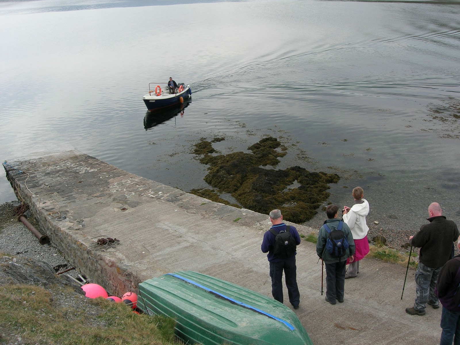 |
The ferry arriving.  |
 |
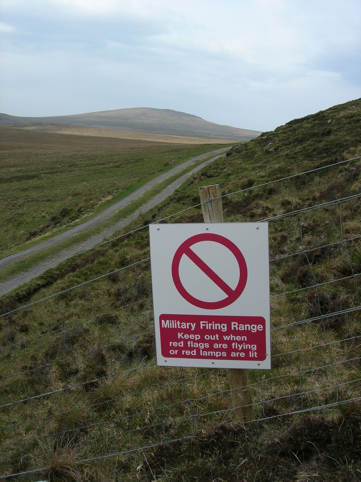
| MOD signs. I checked for MOD exercise dates at the trip planning stage and was informed that May was exercise free. |

 |
| The track to Cape Wrath. Fashven in the distance 1498'. |


 |
| First sight of the Cape Wrath Lighthouse. |


 |
| The view down from next to the lighthouse. |
 |
| The Ozone Cafe at Cape Wrath. |
 |
| Mileposts along the track. |
 |
| Fashven 1498'. |
 |
| Looking south east. |
 |
| Looking south east to Keoldale from the Cape Wrath side of the Kyle of Durness. |
 |
| Day 4. Heading south back along the A838. |
 |
| Overscaig Hotel on the shore of Loch Shin. |
 |
| Some of what the Overscaig Hotel had to offer. |
 |
| Overscaig Hotel from the shore of Loch Shin. |
 |
| Day 5. Bonar Bridge and the bridge taking the A836 across the Kyle of Sutherland. |
 |
| Heading south east on the A836. |
 |
| Approaching the Struie junction. The route leaves the A836 at this point and takes the B9176 over Struie Hill to Alness on the Cromarty Firth. This is the hillier option to taking the longer lower level route through Tain. |
 |
| The layby and viewpoint on Struie overlooking the Dornoch Firth. |
 |
| Kessock Bridge taking the A9 over the Beauly/Moray Firth to Inverness. |
 |
| Day 6. Taking Route 7 through the Cairngorms. This route shadows the A9 for most of the way to Perth. I camped at the Inverness campsite. In the morning I noticed that my rear tyre was almost flat so without any further ado I replaced the innertube. I made the decision to carry on to Newtonmore and replace the innertube at the first convenient opportunity. This did not occur until I reached Newtonmore. I had originally planned to camp a mile or two to the south of town but I had noticed a closed bike shop on the high street which made me decide to seek a nearby b&b. I was attracted to a hotel that was offering discounted rooms for the night - wonderful. I bought a new innertube first thing in the morning. |
 |
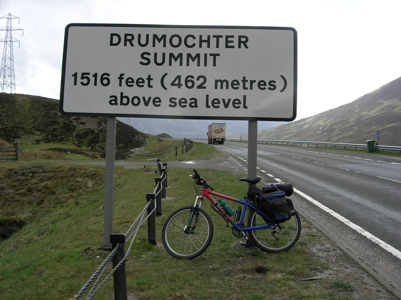
| Day 7. After leaving Newtonmore and before reaching the Drumochter Pass I wasn't prepared to be confronted with extensive road works on the A9 which also affected the adjacent cycletrack. There was a sign saying cycletrack closed and to phone a mobile number. I just saw problems in doing as they suggested so I walked & carried the bike across a largely deserted building site and was fully expecting to be shouted at by one or two workers but I eventually got through to the Dalwhinnie Road. |
 |
| I crossed the A9 to take this photograph. The cycle route runs below the A9 at this point to the right of the road in the picture. |
 |
| Route 7 sign. This is on the old A9 just north of Calvine. |
 |
| Blair Castle from the cycle route on the B8079 approaching the Bridge of Tilt. |
 |
| There is a cafe/tea room at this viewpoint on the route just north of Pitlochry. The Pass of Killiecrankie tea room seemed an odd sort of place to discuss General Custer and his Orcadian ancestry but that is what happened. |
 |
| The Ell - Dunkeld. I remember this "measuring" rod from the time I first visited Dunkeld in the 60s. Dunkeld has ample places in which to eat - I chose a hotel. |
 |
| Dunkeld campsite. A well appointed campsite just a few minutes walk from town. The weather took a turn for the worse here and on Day 8 my camera stayed in its case. Day 8 turned out to be the second longest day in terms of miles covered but the wettest of the whole trip. I took shelter from torrential rain under a bridge arch in Perth when at the time I couldn't see across the River Tay. I took lunch at 1345 at a pub in Kinross where I might have stayed had there been any vacancies. However, I was sufficiently motivated to continue, as planned, to Cramond where I was to meet three members of CycleChat at the Cramond Inn ie Telemark, HJ and Scoosh. |
 |
| Day 9. A brighter morning at the Camping and Caravan Club Site at Cramond on the River Forth. My previous evening's meal was at the Cramond Inn just a couple of miles back along the banks of the Forth. Scoosh kindly returned for me on Day 9 to guide me through Edinburgh to the Dalkeith Road, passing Holyrood Palace and the Scottish Government Buildings enroute. |
 At the top of the climb up the Moorfoot Hills on the B7007, looking north to Edinburgh and the hills of Fife. |
 Although mostly downhill from the top of the Moorfoot Hills I had to pedal most of the way due to the persistently strong headwind. |
 |
| I camped at Innerleithen where the campsite had just refurbished the bar area. I had a pint before I'd even put the tent up. I enjoyed an evening meal at a quiet Italian Restaurant and breakfast was at the Whistlestop on the high street that was nothing short of superb - £7.50. |
 |
| Day 10. I never did see this tea room. |
 |
| On the B709 |
 |
| Clockwatching didn't allow me to call in here, unfortunately. |
 |
| The Tibetan Temple and Tea Room. |
 |
| Still on the B709. |
 |
| On the B6318. The Liddel Water forms the border between England and Scotland at this point. The border took me by surprise as I was hurtling downhill and I had to pedal back for the picture. I had originally planned to camp over in Langholm in Dumfries but I arrived there mid afternoon so I decided to push on to Longtown in Cumbria. I made the decision to b&b in Longtown irrespective of single occupancy rates. Longtown was all a buzz, apparently Lady Gaga was flying in to Carlisle the following day to do what Lady Gaga does best. |
 |
| Day 11. First tea rooms in Kirkby Stephen. I camped at the Kirkby Stephen campsite at the west end of town. A good clean campsite but with an access code to the toilet block which I had to write down for fear of forgetting. I enjoyed an Indian meal in town that evening. |
 |
| Day 12. I was now on familiar ground and my plan was to camp in the Leyburn, North Yorkshire area. However, the pull of home was strong and with a tailwind behind me, at last, I made it home in one go from Kirkby Stephen. My route over the Pennines was by way of Tan Hill to Reeth. |


 |
| Tan Hill. |

 |
| The more usual view of Tan Hill. |
 |
| Back home in Stillington, York. |